
PROJECTS
Woodridge Lake
Aeolus Aerial was asked to capture the beauty of Woodridge Lake and its clubhouse in the quiet town of Goshen, CT. The clubhouse features a variety of amenities including a pool, tennis courts, and several docks. There are also two beaches available to the club members.
Meadow Ridge Farm Haying
As a fun project Aeolus Aerial reached out to Randy Skarupa who works for Meadow Ridge Farm LLC. We wanted to do a video highlighting the process of haymaking. He was excited about having us come and record the process. Not much has changed for farmers as far as when hay needs to be cut however, new technologies and the speed at which it can be cut and stored has changed dramatically. We hope you enjoy watching this video as much as we enjoyed making it.
76.76
New Haven Harbor Video
Aeolus Aerial was asked to help Southern Connecticut State University create a video following their Analytic Techniques and Instrumentation class sample sediment from the New Haven harbor. Aerial video was captured and combined with shots from students and faculty to form a complete presentation from their day on the harbor. The video has been used to promote the class to incoming Environmental Science students.
“The drone video is the highlight of the production and provides a unique perspective of our harbor sampling techniques. The resultant video is a professional production and... an excellent resource in our education and research programs here at SCSU.”
- Professor Vincent Breslin
Cove River Salt Marsh


In an effort to restore the Cove River Salt Marsh in West Haven, Dr. Scott Graves a professor in the Department of the Environment, Geography and Marines Sciences at Southern Connecticut State University asked me and a colleague Peter Broadbridge to take aerial photography of the entire region during various seasons to compile into a 3D map to later analyze. Much of this study has been published in various forms. To learn more about this study and Dr. Grave's work check out this article.
https://news.southernct.edu/tag/scott-graves/
Also, check out his website at https://osprey-smg.com/
Thomaston Congregational Church
Rotting was noticed on Thomaston Congregational Church's steeple. In order to receive an accurate estimate on the cost to repair the steeple, Aeolus Aerial was hired to take photographs of the damage from the sky.
“The church wishes to thank you for your work with the drone photography of our tower. This is so key to us as we continue to analyze the damage done to the tower and prepare for the work that must be done.”
- Pastor Marcus Lee


Real Estate Projects


Aeolus Aerial is actively working with local real estate agents to capture aerial photography of various properties to be used in house listings online and in print. If you are a real estate agent and you are considering using drone photography to promote your sales please take a moment to read the article below.

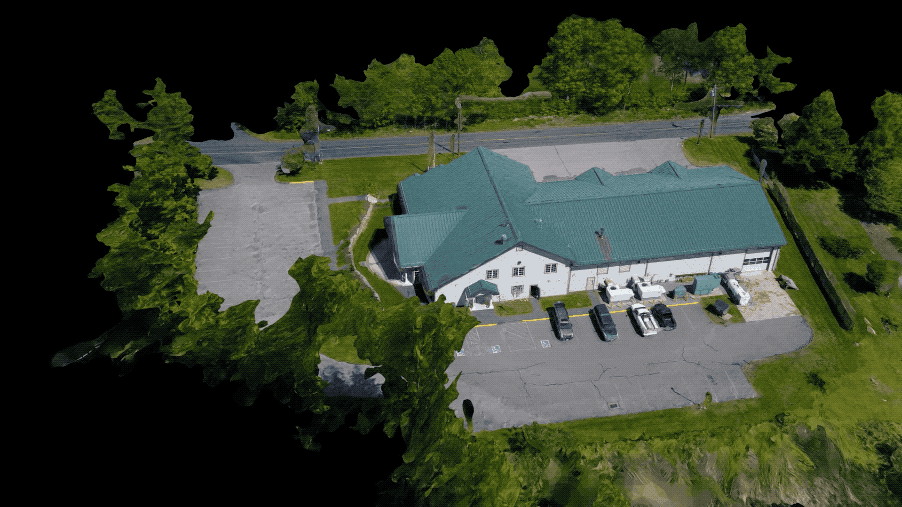
Fire and Rescue Services
Aeolus Aerial was asked by Northfield Fire Company to present to the officers why drones would be helpful to their work in fire and rescue. We presented to the department the following presentation and were asked to be a resource to them. We will be actively working with the department to capture images of drill exercises to be later compiled into a marketing video for new members. Using some mapping techniques, we also prepared for the department a short video animation of the firehouse to show some of the modeling capabilities of the drone.

Forestry Mapping

Aeolus Aerial was asked by the Connecticut Agricultural Experiment Station to fly a mapping mission over a section of a state forest where they had some study plots. Last summer (2018) the area was also hit by a bad Gypsy Moth outbreak which defoliated many of the oak trees within the plot. The purpose of the mission was to determine the feasibility of using drone imagery to determine the crown size of mature trees.
This image created by Peter Broadbridge using Pix4D software. It is a rendering of hundreds of images and took days to complete. Peter is Aeolus Aerial’s resident mapping expert!